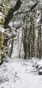
Snow settled in Gladstone on Thursday morning. PHOTO/TRISH THOMSON
High pressure system may sabotage snowfall
ARTHUR HAWKES
[email protected]
The first smatterings of snow settled across Wairarapa’s hill country on Thursday, and more could be on its way next week.
MetService’s extended forecast predicts snow in Masterton next Friday, however these forecasts are generated by computers and could likely change.

The forecast for snow comes after the closure of the Remutaka Hill for a brief period at 4.20am Thursday morning when up to 2cm of snowfall had settled.
By 6am, the hill road had reopened and cars were once again allowed to pass.
Although snowfall is on the cards for next Friday, a MetService spokesman said a high-pressure ridge was approaching the country from the Tasman Sea, making snowfall unlikely.
Snow occurs in lower pressure systems, where warm and cold fronts are forced to converge – this pushes moisture into the air to create clouds and precipitation, which in turn can create snow if the conditions are cold enough.
The meagre offering on Thursday was still enough to encourage several people to pull over to take photos at the Remutaka Hill summit.
The last time snow settled seriously in Wairarapa was in 2011, when the country was hit by record-breaking snowfalls.
The deluge a decade ago was caused by storms in the Antarctic, which moved northward where they then merged with low pressure systems, causing freezing temperatures and major snowfall to strike the region for several days.


